Сб с 10 до 16
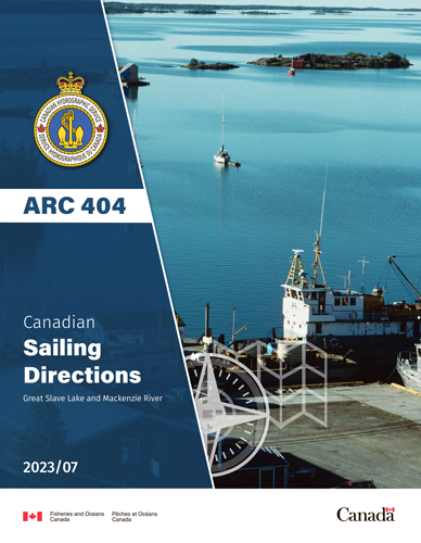
ARC 404 Canadian Sailing Directions. Great Slave Lake and Mackenzie River/Канадские лоции. Большое Невольничье озеро и река Маккензи
Книга на анлийском языке
The First Edition of Sailing Directions, ARC 404 - Great Slave Lake and Mackenzie River, 2012, has been compiled from Canadian Government and other information sources. In general, all hydrographic terms used in this booklet are in accordance with the meanings given in the Hydrographic Dictionary (Special Publication No. 32), published by the International Hydrographic Organization.
This edition introduces a new chapter layout and Print-on-Demand technology.
General information for Northern Canada is grouped in one booklet: Sailing Directions, ARC 400 - General Information, Northern Canada. It contains navigational information and a brief description of the main port facilities as well as geographic, oceanographic and atmospheric characteristics. Booklet ARC 400 also includes a geographical index for Northern Canada.
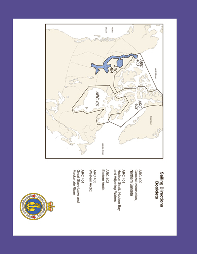
The geographical areas are described in a series of booklets; their limits are shown on the back cover of each booklet. For more information, consult the Catalogue of Nautical Charts and Publications 4, Arctic.
Tidal, water level and current information has been revised by the Tides, Currents and Water Level Section of the Canadian Hydrographic Service.
The photographs, except where credits are given, are by the Canadian Hydrographic Service or the Canadian Coast Guard, Fisheries and Oceans Canada.
Contents
Preface
Explanatory notes
Abbreviations
Chapter 1 Great Slave Lake - West shore General
Great Slave Lake - West Shore
Slave Point to Gypsum Point
Chapter 2 Great Slave Lake - North Arm General
Approach to Yellowknife Bay
Yellowknife Bay
Approach to Hearne Channel
Chapter 3 Great Slave Lake - East arm
General
Off-lying Islands
Entrance Channels
Hearne Channel
Inconnu Channel
Hornby Channel
McLeod Bay
Christie Bay
Chapter 4 Athabasca River - Lake Athabasca - Slave River General
Athabasca River
Lake Athabasca
Athabasca River to Fort Chipewyan
Lake Athabasca to Slave River
Slave River
Upper Slave River
Lower Slave River
Slave River delta
Chapter 5 Great Slave Lake - South shore
General
Slave River delta to Hay River
Hay River
Hay River to Mackenzie River
Chapter 6 Mackenzie River - Great Slave Lake to Morrisey Creek General
Great Slave Lake to Morrisey Creek
Approaches to Mackenzie River
South Channel
Beaver Lake
Providence Rapids
Providence Island to Mills Lake
Mills Lake
Mills Lake to Morrisey Creek
Chapter 7 Mackenzie River - Morrisey Creek to Fort Simpson - Liard River and Fort Nelson River General
Approach to Head-of-the-line
Head-of-the-line to Rabbitskin River
Rabbitskin River to Green Island Rapids
Green Island Rapids
Green Island Rapids to Fort Simpson
Liard River and Fort Nelson River
General
Fort Simpson to Fort Nelson
Chapter 8 Mackenzie River - Fort Simpson to Wrigley General
Fort Simpson to Trail River
Trail River to North Nahanni River
Camsell Bend to Jones Landing
Jones Landing to Wrigley
Chapter 9 Mackenzie River - Wrigley to Tulita (Fort Norman) General
Wrigley to Blackwater River
Blackwater River to Old Fort Point
Old Fort Point to Tulita (Fort Norman)
Chapter 10 Mackenzie River - Great Bear River and Great Bear Lake - Tulita to The Ramparts General
Tulita to The Ramparts
General
Tulita to Norman Wells
Norman Wells to Carcajou Ridge
Approach to Sans Sault Rapids
Sans Sault Rapids and North Rapids
North Rapids to The Ramparts
Ramparts Rapids
Chapter 11 Mackenzie River - The Ramparts to Point Separation General
The Ramparts to Fort Good Hope
Fort Good Hope to Askew Islands
Askew Islands to Bryan Island
Bryan Island to Travaillant River
Travaillant River to Adam Cabin Creek
Adam Cabin Creek to Lower Ramparts
Lower Ramparts
Arctic Red River
Arctic Red River to Point Separation
Chapter 12 Mackenzie River - Mackenzie Delta General
Mackenzie Delta - SW part
Peel River Approaches
Peel River
Peel Channel and Husky Channel
Aklavik Channel
Aklavik
West Channel
Mackenzie Delta - Middle Channel
Point Separation to Aklavik Channel
Aklavik Channel to Napoiak Channel
Napoiak Channel
Napoiak Channel to Neklek Channel
Neklek Channel
Reindeer Channel
Neklek Channel to Mackenzie Bay
Mackenzie Delta - East Channel
East Channel - South Section
Inuvik
Inuvik to Net Point
Net Point to Neklek Channel
Neklek Channel to Lousy Point
Lousy Point to Kittigazuit Bay
Kittigazuit Bay
Kugmallit Bay
Kugmallit Bay - South Side
appendices Sail Plan
Index


