ARC 403 Canadian Sailing Directions. Western Arctic/Канадские лоции. Западная Арктика
Книга на анлийском языке
The First Edition of Sailing Directions, ARC 403 - Western Arctic, 2011, has been compiled from Canadian Government and other information sources. In general, all hydrographic terms used in this booklet are in accordance with the meanings given in the Hydrographic Dictionary (Special Publication No. 32), published by the International Hydrographic Organization.
This edition introduces a new layout of the geographical areas.
General information for Northern Canada is grouped in one booklet: Sailing Directions, ARC 400 - General Information, Northern Canada . It contains navigational information and a brief description of the main port facilities as well as geographic, oceanographic and atmospheric characteristics. Booklet ARC 400 also includes a geographical index for Northern Canada.
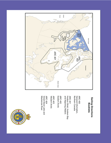
The geographical areas are described in a series of booklets; their limits are shown on the back cover of each booklet. For more information, consult the Catalogue of Nautical Charts and Publications 4, Arctic.
Tidal, water level and current information has been revised by the Tides, Currents and Water Level Section of the Canadian Hydrographic Service.
The photographs, except where credits are given, are by the Canadian Hydrographic Service or the Canadian Coast Guard, Fisheries and Oceans Canada.
Contents
Preface
Explanatory notes
Abbreviations
Chapter 1 Beaufort Sea - Demarcation Point to Kugmallit Bay General
Chapter 2 Beaufort Sea - Kugmallit Bay to Cape Prince Alfred
Chapter 3 Amundsen Gulf - South Part
Chapter 4 Amundsen Gulf - North Part
Chapter 5 Dolphin and Union Strait
Chapter 6 Coronation Gulf - Bathurst Inlet
Chapter 7 Dease Strait - Queen Maud Gulf
Chapter 8 Simpson Strait to Larsen Sound - Coastal route
Chapter 9 Victoria Strait to Parry Channel
Chapter 10 Parry Channel - West part
Chapter 11 Parry Islands - Channels west of Bathurst Island
Chapter 12 Sverdrup Islands - Channels west of Axel Heiberg Island
Appendices Sail Plan
Index


