Сб с 10 до 16
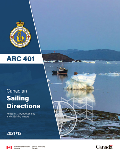
ARC 401 Canadian Sailing Directions. Hudson Strait, Hudson Bay and Adjoining Waters/Канадские лоции. Гудзонов пролив, Гудзонов залив и прилегающие к нему воды
Книга на английском языке
The First Edition of Sailing Directions, ARC 401 - Hudson Strait, Hudson Bay and Adjoining Waters, 2009, has been fully updated from Canadian Government and other information sources. In general, all hydrographic terms used in this booklet are in accordance with the meanings given in the Hydrographic Dictionary (Special Publication No. 32), published by the International Hydrographic Bureau.
This edition introduces the new presention and layout of the Geographical areas.
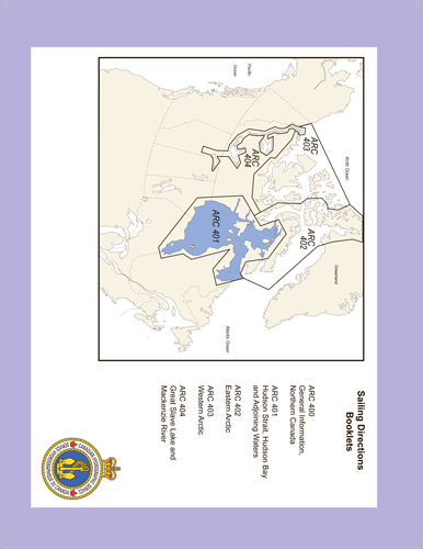
Sailing Directions, ARC 400 - General Information, Northern Canada contains general navigational information and a brief description of the main port facilities and anchorages as well as geographic, oceanographic and atmospheric characteristics of this region.
Detailed descriptions of geographical areas are given in the ARC 401, Arctic Canada Vol. II (ARC 402 ), Arctic Canada Vol. 3 (ARC 403 ) and Great Slave Lake and Mackenzie River (ARC 404 ). Their limits are printed on the back cover. The appropriate descriptive booklet(s) of Sailing Directions should be consulted in conjunction with ARC 400 - General Information, Northern Canada , which provides additional information. Limits of the chapters in this booklet are shown on the inside of the front cover.
Tide, water level and current information has been revised by the Canadian Hydrographic Service.
Photographs are supplied by the Canadian Hydrographic Service and the Canadian Coast Guard, Fisheries and Oceans Canada.
Contents
Preface
Explanatory notes
Abbreviations
Chapter 1 Hudson Strait - South Shore - Ungava Bay General
Ungava Bay - East Shore
Killiniq (Killinek) Island to Cap (Cape) William-Smith
Cap William-Smith to Riviere George (River)
Riviere George and Approaches
Ungava Bay - South Shore
Riviere George to Riviere Koksoak (River)
Approaches to Riviere Koksoak (River)
Riviere Koksoak
Ungava Bay - SW Shore
Riviere Koksoak to Leaf Bay (Baie aux Feuilles)
Leaf Bay and Lac aux Feuilles
Leaf Bay to Hopes Advance Bay
Approaches to Hopes Advance Bay
Hopes Advance Bay to Payne Bay
Approaches to Payne Bay and Riviere Arnaud. (Payne River)
Riviere Arnaud (Payne River)
NW part of Ungava Bay
Akpatok Island
Five Islands to Cap (Cape) Hopes Advance
Chapter 2 Hudson Strait - South Shore - Cap Hopes Advance to Pointe Taliruq (Nuvuc) General
Diana Bay
East side of Diana Bay
Central Islands in Diana Bay
West side of Diana Bay
SW side of Diana Bay
South part of Diana Bay
Diana Bay to Wakeham Bay
Wakeham Bay and Approaches
Wakeham Bay to Douglas Harbour
Fisher Bay
Fisher Bay to Douglas Harbour
Approaches to Douglas Harbour
Off-lying islands
Douglas Harbour
Douglas Harbour to Deception Bay
Foul Bay
Deception Bay
Deception Bay to Cap Wolstenholme
Deception Bay to Sugluk Inlet
Sugluk Inlet
Sugluk Inlet to Erik Cove
Erik Cove to Cap Wolstenholme
Cap Wolstenholme to Pointe Taliruq (Nuvuc)
Digges Islands
Passe Digges (Sound)
Mainland coast of Passe Digges
Chapter 3 Hudson Strait - North Shore General
Resolution Island
East, south and SW coasts
Resolution Harbour
Cape Warwick to Baffin Island
Baffin Island - East Bluff to Lake Harbour
Kimmirut (hamlet of Lake Harbour) and approaches
Lake Harbour to Fair Ness
SE shore of Big Island
SW shore of Big Island
Big Island to Fair Ness
Fair Ness to Chorkbak Inlet
Chorkbak Inlet to Cape Dorset
Cape Dorset and approaches
Cape Dorset to Lloyd Point:
Chapter 4 Hudson Bay - East Side
General
Pointe Taliruq to Cape Smith
Ice Harbour to Pointe Bernier
Offshore islands
Pointe Bernier to Cape Smith
Cape Smith to Akulivik
Cape Smith to Cape Dufferin
Pointe Akulivik to Povungnituk Bay
Approaches to Puvirnituq (Povungnituk)
Offshore islands
Povungnituk Bay to Cape Dufferin
Cape Dufferin to Nastapoka Islands
Cape Dufferin to Inukjuak
Approaches to Inukjuak
Inukjuak to Riviere Nastapoka
Offshore Islands - Marcopeet, Sleeper and King George Islands
Offshore islands - Belcher Islands
Belcher Islands - North part
Belcher Islands - South part
Nastapoka Islands
Riviere Nastapoka to Le Goulet
Approaches to Umiujaq
Umiujaq to Le Goulet
Le Goulet to Pointe Louis-XIV
Le Goulet to Grande riviere de la Baleine
Approaches to Kuujjuarapik (Poste-de-la-Baleine)
Grande riviere de la Baleine to Long Island
Long Island and Long Island Sound
Chapter 5 James Bay
General
James Bay - East shore
Pointe Louis-XIV to Fort George (Fort-George) and Chisasibi
Approaches to Fort George (Fort-George) and Chisasibi
Fort George and Chisasibi to Wemindji
Offshore islands
Approaches to Wemindji
Wemindji to Eastmain
Offshore islands
Approaches to Eastmain
Eastmain to Waskaganish (Fort-Rupert)
Rupert Bay
Approaches to Waskaganish (Fort-Rupert)
Waskaganish to Hannah Bay
James Bay - West shore
Cape Henrietta Maria to Albany River
Offshore islands
Approaches to Attawapiskat
Approaches to Kashechewan and Fort Albany
Albany River to Moosonee
Approaches to Moose River
Chapter 6 Southampton Island (South Side) and Chesterfield Inlet
Southampton Island (South Side) - General
Seahorse Point to Coral Harbour
Evans Strait
Fisher Strait
Coral Harbour and approaches
Coral Harbour to Cape Kendall
Hudson Bay - NW shore - Cape Fullerton to Chesterfield Inlet
Approaches to Chesterfield Inlet
Chesterfield Inlet - General
Chesterfield Inlet entrance to Ellis Island
Ellis Island to Centre Island
Centre Island to Farther Hope Point
Farther Hope Point to Terror Point
Terror Point to Baleen Island
Baleen Island to Chesterfield Narrows
Chesterfield Narrows
Baker Lake
Chesterfield Narrows to James Point
James Point to Baker Lake hamlet
Baker Lake Harbour
Chapter 7 Hudson Bay -р West Side
General
Chesterfield Inlet to Rankin Inlet
Rankin Inlet and approaches
Rankin Inlet to Eskimo Point
Rankin Inlet to Whale Cove
Whale Cove and approaches
Walrus Island to Eskimo Point
Eskimo Point and approaches
Eskimo Point to Churchill
Eskimo Point to Egg Island
Egg Island to Churchill
Approaches to Churchill Harbour
Churchill Harbour
Port of Churchill
Churchill to James Bay
Cape Churchill to Cape Tatnam
Cape Tatnam to Fort Severn
Fort Severn to Winisk River
Winisk River to Cape Henrietta Maria
Chapter 8 Foxe Channel - Roes Welcome Sound
General
Foxe Channel
Offshore dangers
West side of Foxe Channel - Southampton Island
East side of Foxe Channel
Frozen Strait
SW side of Frozen Strait and approaches
Duke of York Bay
Comer Strait
West side of Frozen Strait
East side of Frozen Strait
Hurd Channel
SE coast of Melville Peninsula
Gore Bay and Moyle Bay
Lyon and Hoppner Inlets
Winter Island to Cape Wilson
Roes Welcome Sound
East side of Roes Welcome Sound
SW side of Roes Welcome Sound
Wager Bay
NW side of Roes Welcome Sound
Repulse Bay
Talun Bay
Chapter 9 Foxe Basin - Fury and Hecla Strait
Foxe Basin - General
West side of Foxe Basin
Cape Wilson to Hall Beach
Hall Beach
Hall Beach to Hooper Inlet
Hooper Inlet
Igloolik
South and east sides of Foxe Basin
Foxe Peninsula - North Coast
East side of Foxe Basin - Bowman Bay to Point Peters
Prince Charles and Air Force Islands
North shores of Foxe Basin
Jens Munk Island to Cape Thalbitzer
Cape Thalbitzer to Reid Point
Islands in north part of Foxe Basin
Spicer and Manning Islands
Rowley Island
East shore of Rowley Island
West shore of Rowley Island
Labrador Channel and Koch Island
Bray Island
SW approaches to Longstaff Bluff
SE and east approaches to Longstaff Bluff
Longstaff Bluff
Fury and Hecla Strait - General
Fury and Hecla Strait - SE entrance - Islands
SE approaches to Labrador Narrows
NE approaches to Labrador Narrows
Gifford Fiord
Labrador Narrows to Gulf of Boothia
South shore - Cape Lilly to Cape Englefield
appendices Sail Plan
Index


