CEN 309 Canadian Sailing Directions. Trent-Severn Waterway/Канадские лоции. Водный путь Трент-Северн
Книга на английском языке
The First Edition of Sailing Directions, CEN 309 - Trent-Severn Waterway, 2016, has been compiled from Canadian Government and other information sources. In general, hydrographic terms used in this booklet are in accordance with the meanings given in the Hydrographic Dictionary (Special Publication No. 32), published by the International Hydrographic Organization.
This edition introduces a new chapter layout and Print-on-Demand technology.
General information for the Great Lakes is grouped in one booklet: Sailing Directions, CEN 300 - General Information, Great Lakes . It contains navigational information and a brief description of the main port facilities as well as geographic, oceanographic and atmospheric characteristics. Booklet CEN 300 also includes a geographical index for the Great Lakes area.
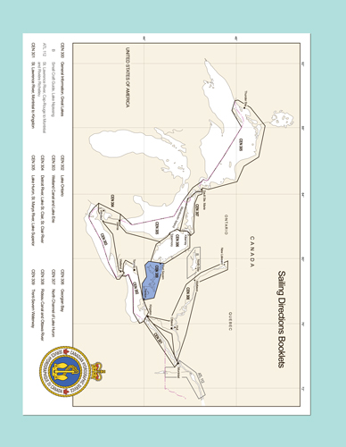
The detailed description of the geographical areas is given in a series of booklets. Their limits are printed on the back cover of the booklets. The appropriate descriptive booklet(s) should be consulted in conjunction with the CEN 300 - General Information, Great Lakes booklet.
Tidal, water level and current information has been revised by the Tides, Currents and Water Level Section of the Canadian Hydrographic Service.
The photographs are by the Canadian Hydrographic Service, Fisheries and Oceans Canada, unless otherwise attributed. Lock photographs are courtesy of Trent-Severn Waterway National Historic Site of Canada, Parks Canada.
Contents
Preface
Explanatory notes
Abbreviations
Chapter 1 General Information
Trent-Severn Waterway
Historical Background
Navigation Notes
Water Levels
Currents
Meteorological Information
Publications
Regulations
Aids to Navigation
Cables
Use of Radio
Search and Rescue
Chapter 2 Trenton to Rice Lake
Presqu’ile Bay
Murray Canal to Trenton
Trenton
Trenton to Glen Ross
Glen Ross to Haig’s Reach lock
Haig’s Reach to Campbellford
Campbellford
Campbellford to Healey Falls
Healey Falls to Rice Lake
Chapter 3 Rice Lake
Rice Lake - North Shore
Cameron Point to Indian River
Rice Lake - East Shore
Webb Bay to Harwood
Rice Lake - NW Shore
Roach Point to Hatrick Point
Rice Lake - SE Shore
Harwood to Bewdley
Bewdley
Rice Lake - West Shore
Bewdley to Otonabee River
Chapter 4 Rice Lake to Buckhorn
Otonabee River and Trent Canal
Rice Lake to Peterborough
Peterborough
Peterborough lift lock
Peterborough to Lakefield
Lakefield to Burleigh Falls
Stony Lake
Burleigh Falls
Burleigh Falls to Buckhorn
Buckhorn
Chapter 5 Buckhorn to Lake Simcoe
Buckhorn to Gannon Narrows
Chemong Lake
Bridgenorth
Gannon Narrows to Bobcaygeon
Bobcaygeon
Pigeon Lake - South part
Pigeon Lake - North part
Bobcaygeon to Sturgeon Point
Scugog River
Lindsay
Lake Scugog
Sturgeon Point to Fenelon Falls
Fenelon Falls
Fenelon Falls to Balsam Lake
Rosedale
Balsam Lake
Balsam Lake to Lake Simcoe
Chapter 6 Lake Simcoe
NE shore of Lake Simcoe
East and SE shores of Lake Simcoe
Cook’s Bay
Holland River
SW shore of Lake Simcoe
Kempenfelt Bay
Barrie
NW shore of Lake Simcoe
Chapter 7 Lake Simcoe to Port Severn
Lake Simcoe to Couchiching lock
Orillia
The Narrows to Couchiching lock
Couchiching lock to Big Chute
Big Chute to Port Severn
Port Severn
appendices Sail Plan
Meteorological Tables
Distance and Trent-Severn Waterway Information Table
Index


