CEN 308 Canadian Sailing Directions. Rideau Canal and Ottawa River/Канадские лоции. Канал Ридо и река Оттава
Книга на английском языке
This First Edition of Sailing Directions, CEN 308 - Rideau Canal and Ottawa River, 2003, has been compiled from Canadian Government and other information sources. In general, hydrographic terms used in this booklet are in accordance with the meanings given in the Hydrographic Dictionary (Special Publication No. 32), published by the International Hydrographic Bureau.
This edition uses a new presentation of the description of the geographical areas.
General information for the Great Lakes is grouped in one booklet: Sailing Directions, CEN 300 - General Information, Great Lakes . It contains navigational information and a brief description of the main port facilities as well as geographic, oceanographic and atmospheric characteristics. Booklet CEN 300 also includes a geographical index for the Great Lakes area.
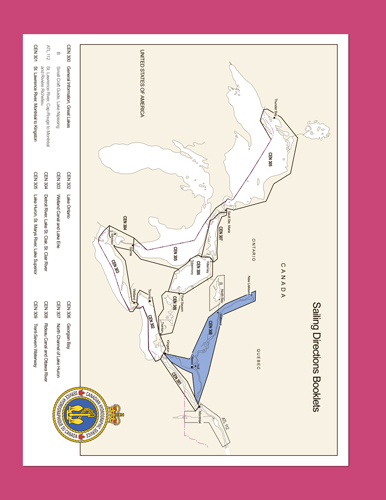
The geographical areas are described in a series of booklets; their limits are shown on the back cover of each booklet. For more information, consult the Catalogue of Nautical Charts and Publications 3, Ontario/Manitoba, Including the Great Lakes.
Tidal, water level and current information has been revised by the Tides, Currents and Water Level Section of the Canadian Hydrographic Service.
The information quoted from the List of Lights, Buoys and Fog Signals in the Appendix is updated monthly by the Canadian Coast Guard and is available at the Fisheries and Oceans Canada web site: www.notmar.com.
The photographs are by the Canadian Hydrographic Service, Fisheries and Oceans Canada.
Contents
Preface
Explanatory notes
Abbreviations
Chapter 1 General Information
General
Aids to navigation
Cables
Hospitals
Rideau Canal
Ottawa River
Multibeam survey of Lake Timiskaming
Historical Background
The Rideau Canal
The Building of the Canal
The Protection of the Canal
The Use of the Canal
Ottawa River
Interesting and useful websites
Chapter 2 Rideau Canal - Ottawa to Smiths Falls
General
The National Capital Region
Ottawa to Long Island
Ottawa River entrance to Hogs Back locks
Hogs Back locks to Long Island
Long Island to Becketts Landing
Long Island locks to Kars
Kars to Becketts Landing
Becketts Landing to Smiths Falls
Becketts Landing to Burritts Rapids
Burritts Rapids to Merrickville
Merrickville to Edmonds lock
Edmonds lock to Smiths Falls
Smiths Falls
Chapter 3 Rideau Canal - Smiths Falls to Newboro lock
General
Smiths Falls to Rocky Narrows
Smiths Falls to Poonamalie lock
Poonamalie lock to Stonehouse Island
Tay River Branch to Perth
Stonehouse Island to Rideau Ferry
Rideau Ferry to Rocky Narrows
Rocky Narrows to Newboro
Rocky Narrows to Narrows lock
Northern approach to Portland
Portland
Western approach to Portland
Narrows lock to Westport and Newboro
West arm of Upper Rideau Lake and approach to Westporl
Westport
Approach to Newboro
Chapter 4 Rideau Canal - Newboro to Kingston
General
Newboro to Jones Falls
Newboro
Newboro lock to Chaffeys Locks
Chaffeys Locks to Jones Falls
Jones Falls to Cranberry Lake
Jones Falls to Seeleys Bay
Seeleys Bay
Seeleys Bay to Cranberry Lake
Cranberry Lake to Kingston
Cranberry Lake to River Styx
River Styx to Kingston Mills
Kingston Mills to Kingston
Chapter 5 Upper Ottawa River - Ottawa to tie Marcotte
General
Ottawa to Chats Falls
Britannia Bay to Breckenridge
Breckenridge to MacLaren’s Landing
MacLaren’s Landing to Chats Falls
Chats Falls to Chenaux and Portage-du-Fort
Chats Falls to Arnprior
Arnprior
Arnprior to Iles Kennedy
Iles Kennedy to Chenaux Island
Chenaux Island to Portage-du-Fort
Portage-du-Fort
Portage-du-Fort to Ile Marcotte
Portage-du-Fort to Chute du Grand Calumet and Bryson
Bryson to Lac Coulonge
Lac Coulonge
Lac Coulonge to Ile Marcotte
Chenal de la Culbute
L’lles-aux-Allumettes
Chapter 6 Upper Ottawa River - tie Marcotte to Otto Holden dam General
Ile Marcotte to Balmer Bay
Ile Marcotte to Ile Morrison
Ile Morrison to Pembroke
Pembroke
Pembroke to Ile D’Arcy
Ile D’Arcy to Deep River Islet
Deep River Islet to Balmer Bay
Balmer Bay to Rapides-des-Joachims
Balmer Bay to Deep River
Deep River
Deep River to Rapides-des-Joachims
Rapides-des-Joachims
Rapides-des-Joachims and Rolphton to Otto Holden dam
Rolphton to Maraboo Lake
Maraboo Lake to Deux Rivieres
Deux Rivieres
Deux Rivieres to Bald Rock
Bald Rock to Mattawa
Mattawa
Mattawa to Lac la Cave
Chapter 7 Upper Ottawa River - Lac la Cave and Lake Timiskaming
General
Lac la Cave
Temiscaming to Pointe Chabot
Temiscaming
Temiscaming to Chenal Opimica
Chenal Opimica to Grand Campment Bay
Grand Campment Bay to Pointe Martel
Pointe Martel to Pointe Chabot
Pointe Chabot to Notre-Dame-du-Nord
Pointe Chabot to ile Mann
ile Mann to New Liskeard
New Liskeard to Notre-Dame-du-Nord
Chapter 8 Ottawa River - Ottawa to Carillon
General
Ottawa to Becketts Creek
Ottawa to Ile Kettle
ile Kettle to Becketts Creek
Becketts Creek to Papineauville
Becketts Creek to Wendover
Wendover to Papineauville
Papineauville to L’Orignal
Papineauville to Montebello
Montebello to L’Orignal
L’Orignal to Carillon
L’Orignal to Hawkesbury
Hawkesbury to Carillon
Chapter 9 Ottawa River - Carillon to Sainte-Anne-de-Bellevue and Laval
General
Carillon lock to Lac des Deux Montagnes
Carillon lock to ile de Carillon
Lac des Deux Montagnes - Western part
ile de Carillon to ile aux Tourtes
ile aux Tourtes to Sainte-Anne-de-Bellevue
ile aux Tourtes to Vaudreuil-Dorion
Lac des Deux Montagnes - Northeast part
ile aux Tourtes to Laval-sur-le-Lac
Riviere des Prairies
Riviere des Prairies - NE branch
Riviere des Prairies - SE of ile Bizard
Riviere des Prairies - East of ile Pariseau
Appendices Sail Plan
Table of Marine Facilities
List of Lights, Buoys and Fog Signals
Index


