Сб с 10 до 16
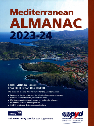
Mediterranean Almanac 2023-24
Издание на английском языке.
The essential marine data resource for yachts sailing the Mediterranean, the Imray Mediterranean Almanac is published biennially with updates available in a downloadable supplement at the end of the first year. The harbour information section, with plans of the major harbours and marinas, is now a core part of every yachtsman’s almanac, and the Imray Mediterranean Almanac has a significant part of the volume devoted to this information. Harbour plans are restricted to a selection of major harbours or smaller harbours commonly used by yachts, including many of the marinas in the Mediterranean. There are a number of good pilots available for most of the countries around the Mediterranean and where there are gaps we have endeavoured to provide as many harbour plans as possible. On passage you can safely get around the Mediterranean using the harbour plans in the almanac, but if you are exploring a region then you will need the relevant pilot for that country or area.
Contents
1. About the almanac
1.1 Introduction
1.2 Nomenclature
1.3 Abbreviations
1.4 Compass
1.5 Corrections
2. Safety and distress
2.1 Distress signals
2.2 Life saving signals
2.3 DSC distress and safety calling frequencies
2.4 Making a distress call
2.5 Phonetic alphabet
2.6 Emergency radio & telephone services
2.7 GMDSS
2.8 Salvage
3. Radio and satellite services
3.1 Coast radio regulations
3.2 Call sign allocations
3.3 Classification of emissions
3.4 Transmitting frequencies
3.5 Coast radio services
3.6 Traffic services (VTS & TSS)
3.7 AIS
3.8 NAVTEX
3.9 Weatherfax
3.10 GPS
3.11 Telecommunications
3.12 Satellite systems
3.13 HF radio data
3.14 EPIRBS & SARTS
3.15 BBC World Service frequencies
4. Weather services
4.1 Radio weather services
4.2 NAVTEX transmitters
4.3 Weatherfax broadcasts
4.4 Satellite weather services
4.5 RTTY forecasts
4.6 Weather by email
4.7 GRIB weather files
4.8 Weather on the internet
4.9 Weather apps
4.10 Wind speed conversions
5. Regulations and documentation
5.1 Eight-language glossary of terms used
5.2 Safety regulations for private pleasure vessels
5.3 SOLAS regulations
5.4 Safety equipment
5.5 MARPOL regulations
5.6 UNCLOS regulations
5.7 EU laws for yachts
5.8 General documents
5.9 Regulations country by country
5.10 Marine reserves in the Mediterranean
5.11 Assistance
5.12 Useful addresses and dialling codes
6. Lights
6.1 International Port Signals
6.2 IALA Buoyage System A
6.3 Light characteristics
7. Charts
7.1 Symbols used on charts
7.2 Chart coverage of the Mediterranean
8. Routes within the Mediterranean
8.1 Distance charts
8.2 Distance tables
9. Tides
9.1 Tidal differences on Gibraltar
9.2 Gibraltar tidal curve
9.3 Gibraltar tides 2019
10. Harbour information key to symbols, Quick reference guides, Gibraltar Strait tidal streams, Mediterranean yacht rallies
10.1 Gibraltar
10.2 Spain
10.3 France & Corsica, Monaco
10.4 Italy
10.5 Malta
10.6 Slovenia
10.7 Croatia
10.8 Bosnia-Herzegovina
10.9 Montenegro
10.10 Albania
10.11 Greece
10.12 Turkey
10.13 Cyprus
10.14 Syria
10.15 Lebanon
10.16 Israel
10.17 Egypt
10.18 Libya
10.19 Tunisia
10.20 Algeria
10.21 Morocco
10.22 Atlantic Islands
11. Calendars
Calendars
Index
General Index


