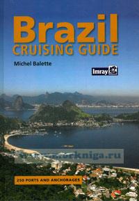
Brazil Cruising Guide
We crossed the Atlantic in our boat Izarra, arriving in Brazil with the intention of spending just a few months in the country as many have done in the past. That initial stay has led on to one of several years. We sail from island to island, from anchorage to anchorage and from one port to the next, each place strangely different but friendly, we have discovered new and different scenery, and constantly meet new and delightful people.
The Brazilian coastline extends for over 4,000 miles, and much time is needed to explore its coasts and rivers.
The marine charts published by the Centro de Hidrografia cover the coastal zone very well, but there can be certain risks when navigating the watercourses; there are some areas for which the hydrographical information does not always exist, and at entrances to rivers there may be shifting sandbanks, the position of which can vary as a result of seasonal changes and meteorological conditions.
The coast of this vast country is divided into three very different regions, both in terms of geography and of population and climate.
The north and northeast
• From Belem and its major river port to the mouths of the Rio Amazonas, a river so huge that its milky coffee-coloured waters are discharged far out to sea.
• The state of Bahia, strongly influenced by African culture, many of whose traditions have been preserved and are still practised to the present day; Salvador, a city where the colonial past is evident everywhere, in its architecture, its traditions and the Bahian way of life. The majority of the population here is black or half-caste, smiling, welcoming and obliging, and little concerned about the material side of everyday life.
Содержание:
Contents
Preface
Acknowledments
Introduction
General information
History
Geography
Population
Cuisine and drinks
Entering Brazil by boat
Navigation aids and information
Tides and currents
List of main lighthouses
Salvamar system of sea search and rescue
The RENEC national network of coast radio stations
List of Capitanias dos Portos
Climate and weather
I. Southwards from Salvador de Bahia to Rio Grande do Sul
STATE OF BAHIA
Baia de Todos os Santos
Baia de Todos os Santos marinas
late clube da Bahia
Bahia Marina
Terminal nautico da Bahia
Porto da Barra
Ribeira - Baia de Itapagipe
Baia do Aratu
llha de Mare
llha Itaparica
llha Matarandiba - Cachoeira de Itororo
Cacha Prego
llha do Frade
llha do Bom Jesus dos Passos
lha Madre de Deus
llha Maria Guarda
llha Bimbarras
llha dasVacas
Salinas de Margarida
llha do Medo
Rio Paraguacu
Maragogipe
Baia de Iguape
Arquipelago de Tinhare
Valenca
Baia de Camamu
llha do Campinho
Itacare
Porto de llheus
Santo Andre - Santa Cruz
Porto Seguro
Caravelas
Arquipelago dosAbrolhos
STATE OF ESPiRITO SANTO
Barra do Riacho
Baia do Espirito Santo Vitoria and Tubarao
late Clube Marina
Hotel llha do Boi Marina
Enseada de Guarapari
Anchorages
Porto de Ubu
STATE OF RIO DE JANEIRO
Enseada de Buzios
Cabo Frio
Arraial do Cabo
Rio de Janeiro - Baia de Guanabara
Niteroi
Other anchorages and yacht clubs in Baia de Guanabara
Rio de Janeiro
Baia da llha Grande
llha Grande
Angra dos Reis
East of Angra dos Reis
West of Angra dos Reis
Angra dos Reis to Paraty
STATE OF SAO PAULO
Ubatuba
Sao Sebastiao - llhabela
Santos - Guaruja - Bertioga
Santos Marinas
Santos - Guaruja
STATE OF PARANA
Baia de Paranagua
Baia deGuaratuba
STATE OF SANTA С ATARI N A
Sao Francisco do Sul
Sao Francisco do Sul to llha Santa Catarina
Enseada de Porto Belo
Baia das Tijucas
llha Santa Catarina - Florianopolis
Baia Norte
Baia Sul
STATE OF RIO GRANDE DO SUL
II. Northwards from Salvador de Bahia to Belem
STATE OF ALAGOAS
Maceio
STATE OF PERNAMBUCO,
Porto de Suape
Porto de Recife
Olinda
Fernando de Noronha
STATE OF PARAiBA
Joao Pessoa - Cabedelo
STATE OF RIO GRANDE DO NORTE
Natal
STATE OF CEARA
Fortaleza
FORTALEZA TO THE RIO PARA
STATE OF PARA
Belem
llha de Marajo
Appendix
Brazilian Portuguese - English glossary
List of Brazilian Navy Charts
Distance tables
Index

 The Normandy Coast From the Air
  Cruising Guide to the Virgin Islands 2009/2011
  The Yachtsman's Guide to Jamaica