Сб с 10 до 16
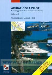
Adriatic Sea Pilot Volume I. Адриатическое море. Часть I
Summary of corrections 2014
Croatian part of the Adriatic with an archipelago of over a thousand islands, its crystal clear sea and favourable climate is a marvellous cruising area, a paradise for boaters. With their increasing interest for this coast, necessary facilities have been built - modern marinas and small harbours - to offer stay, supply and maintenance to small craft and yachts, providing all kinds of information, on weather or cultural and sports events in the area of their interest.
The first edition of this Pilot published by the Hydrographic Institute of the Republic of Croatia is complementary with its regularly issued and updated charts and official publications. Besides providing up-to-date information relevant to the safety at sea and all the facts on harbours and marinas, it also offers background information on cultural and historical sights, national parks and other natural attractions on the coast and islands, and in the close interior.
We hope that the information contained in this Pilot will prove to be useful to everyone cruising in this area, whose comments and suggestions would be a valuable help in our mission to ensure safe navigation in these waters.
CONTENTS
Preface
Contents
CHAPTERA A
Explanatory notes
Glossary
Chart index diagram
Symbols and abbreviations
CHAPTER В-I
Geographic and hydrographic information
Oceanographic information
Meteorological information
Magnetic declination (variation)
CHAPTER B-II
General information
Important notices and regulations
Global Maritime Distress and Safety System
Search and Rescue at Sea
Buoyage System (IALA)
CHAPTER C-I
West coast of Istria (from Piranski Zaljev to Rt Kamenjak) (introduction)
West coast of Istria
Piranski Zaljev
Limski Kanal
Fazanski Kanal
Brijuni islands
Southern extremity of Istria
CHAPTER C-II
Kvarner (Vela Vrata, west coasts of Cres and Losinj islands) (introduction)
Kvarner and Vela Vrata
East coast of Istria from Rt Kamenjak to Rt Sip
Medulinski Zaljev
Zaljev Rasa
West coast of Cres island
Zaljev Valun
Osorski Zaljev
Osorski Tjesnac
Unijski Kanal
West coast of Losinj island
CHAPTER C-III
Rijecki Zaljev (introduction)
Rijecki Zaljev
Bakarski Zaljev
West coast of Krk island
Omisaljski Zaljev
CHAPTER C-IV
Kvarneric and approach channels (introduction)
Kvarneric and approach channels
Krcki Zaljev
Southern coast of Krk island
Grgurov Kanal
Rapski Kanal
Northeast coast of Rab island
North coast of Rab island
Northwest coast of Rab island
Southwest coast of Rab island
Barbatski Kanal
Paski Kanal
Northeast coast of Pag island
Southwest coast of Pag island
East coast of Cres island
Southeast coast of Cres island
Southwest coast of Cres island
Losinjski Kanal
East coast of Losinj island
CHAPTER C-V
Tihi Kanal.Vinodolski Kanal.Velebitski Kanal and Novigradsko More (introduction)
Tihi Kanal.Vinodolski Kanal.Velebitski Kanal and Novigradsko More
Tihi Kanal
Vinodolski Kanal
Velebitski Kanal
Vinodolski Kanal and north part ofVelebitski Kanal
Northeast coast of Krk island
Mainland coast from Rt Ertak to Jablanac
Middle part of Velebitski Kanal
Northeast coast of Pag island
Paski Zaljev
Southern part of Velebitski Kanal - Novsko Zdrilo - Novigradsko More - Karinsko More
Mainland coast from the cove Sv. Magdalena to the channel Novsko Zdrilo
The Zrmanja river
CHAPTER C-VI
Virsko More with the channels Maknare, Sedmovrace and Privlacki Gaz (introduction)
Virsko More with the channels Maknare, Sedmovrace and Privlacki Gaz
Maunski Kanal
Southwest coast of Pag island
Kosljunski Zaljev
Kanal Nove Povljane
Privlacki Zaton
Ninsko-Ljubacki Kanal
Ninski Zaljev
Passage between Rt Jasenovo and Rt Prutna
Ljubacki Zaljev
Veliki Sikavac and Mali Sikavac islets
Pohlipski Kanal
Olipski Kanal
Silbanski Kanal
Islets, above-water rocks and shoals southwest of 1st and Molat islands
Prolaz Zapuntel
Brguljski Zaljev
Prolaz Maknare and Sedmovrace
Passage between Molat and Sestrunj islands
CHAPTER D
Appendix
Index

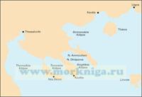
 G21 Northwest Aegean Северо-западная часть Эгейского моря (1:275 000)
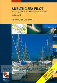
  Adriatic Sea Pilot Volume II. Адриатическое море. Часть II
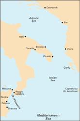
  M30 Southern Adriatic and Ionian Seas Южное Адриатическое и Ионическое моря (1:850 000)