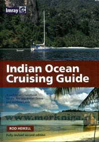
Indian Ocean Cruising Guide Острова и побережья Индийского океана, Красное море
Every effort has been made to ensure the accuracy of this book. It contains selected information and thus is not definitive and does not include all known information on the subject in hand; this is particularly relevant to the plans, which should not be used for navigation. The author believes that his selection is a useful aid to prudent navigation, but the safety of a vessel depends ultimately on the judgement of the navigator, who should assess all information, published or unpublished.
Contents
Preface
Introduction
The Indian Ocean and the limits and purpose of this book
Cruising in the Tropics
Stores along the way
Piracy
War zones and civil unrest
Diving
Fishing
Cultures and poverty
Health matters
Bureaucracy
Technical information
Cruising highways
Climate change
Prevailing winds
ITCZ
Tropical storms and cyclones
Weather forecasts
Currents
Passages westabout
Passages eastabout
I. NORTHERN INDIAN OCEAN Singapore
Indonesia
Malaysia
Thailand
Burma
Andaman Islands
Nicobar Islands
Sri Lanka
India
Maldives
Pakistan
Dubai
Oman
Yemen
Somalia
Red Sea
II. SOUTHERN INDIAN OCEAN
Australia 211 Ashmore Reef 216 Christmas Island 216 Cocos Keeling 218 Chagos archipelago 222 Seychelles 227 Rodrigues 236 Mauritius 238 Reunion 242 Comoros 244 Mayotte 245 Madagascar 247 South Africa 252
Mozambique, Tanzania and Zanzibar 254 Kenya, 256
Appendix
I. Hydrographic publications, 265
II. Yachtsman's guides, 265
III. Useful books, 266
IV. Software, 266
V. Websites, 267
VI. Charts for the Indian Ocean, 267 Index 268

 Русско-английский тематический словарь яхтсмена
  МППСС - 72, Адм. № 9018 Р